
Big Sur is a beautiful place accustomed with viewpoints right along this jagged-edge highway, filled with twists and turns at every corner. It offers spectacular viewpoints accessible for everyone and is also equipped with three State Parks for the hiking enthusiasts; Julia Pfeiffer, Pfeiffer, and Andrew Molera.
This remote stretch of highway has approximately 85 miles of scenery. You can make this destination last from one day to a few days and possibly even more! I personally spent three days and it took me that long to hike pretty much all the trails. And now I can give good advice on what to expect on these trails so you can pick your perfect trail or trails to hike!
This destination, though beautiful, is kind of a tourist trap. Watch out for pricey accommodations! But here I will give tips on parking for free! And if you don’t mind primitive camping, there is a first-come-first-serve campground at Andrew Molera State Park. It is the only first-come-first-serve campground in the area.
Julia Pfeiffer Burns State Park
This park is a 4 square mile park offering two day hikes. One coastal trail that goes to the Pacific Ocean and one that goes into the redwoods, topping on this overlook with great oceanic views!
McWay Falls Trail– .6 miles RT (roundtrip). Offers a waterfall that dumps right into the Pacific Ocean. The cove is what really makes this destination eye-opening. The falls use to rush with flowing water, but with the drought, the falls don’t have the same abundance of what it used to. The destination is still beautiful though, especially the cove.

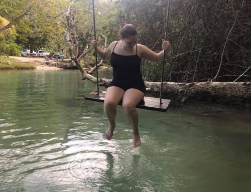
The water is so clear!
E Woldsen Loop– 5 mile loop with an extra .5 miles to the overlook point on top. So really 6 miles. This hike is pretty exhausting covering an adequate amount of elevation. You pretty much have an up-hill accent to the half-way point. So about 2.5 miles you are going up-hill. Make sure you bring a lunch and plenty of water! Also, you may be exhausted by the time you reach the halfway point, but this won’t bring you to the overlook.

Through the red woods we go!
It is so worth going that extra .5 miles to the top. You will see the sign. It is an additional trail. You will go from seeing a little of the coast to seeing an amazing overlook. There is even the opportunity in seeing a near-by whale! Hiking poles may help with the accent! I know they helped me.
Free Parking- If you go into the parking lot, the rangers will charge you 10 dollars to park. If you park right off of highway 1, its free! And that goes for all three of the State Parks. And there is not much more hiking involved. The three State Parks are literally right off the highway and so are the trailheads. The farthest State Park from the highway is Andrew Molera with a steep road heading down to the trail-heads, but even this one is roughly a quarter mile. There all very close! If you are only going to be there for a day, then maybe you would want to pay the ten dollars because one pass is good for all three in that same day.
Pfeiffer Big Sur State Park
This State Park encompasses about 1,006 acres of land and has multiple hikes from simple .5 mile trails to long and strenuous backpacking trails. This park does not take you to the ocean. However, the features of this park are waterfalls, overlooks, nature trails, hot springs and rivers.

River Path and Wardens Path– .6 mile loop. This path is wheelchair accessible, fortified with picnic areas and also allows dogs. This trail follows along the Big Sur River.
Nature Trail-.7miles RT. This trail is an easy self-guided hike to give you a chance to learn about the nearby plants.
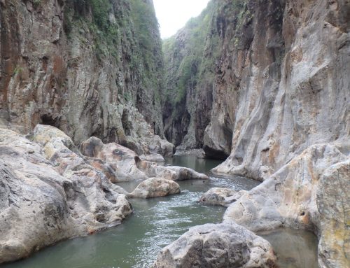
Big Sur River Gorge– .5miles RT. Empties into the river, which gives you the chance to swim around. It is common seeing rock-climbers here, climbing the nearby rocks.

Pfeiffer Falls and Valley View Trail– 2 mile RT moderate hike. It climbs 750 feet uphill through redwood trees and oak woodlands. This hike offers both a view and falls. When you approach the fork, you can take the left fork to the Valley View which offers an overlook of the Big Sur River Gorge, Point Big Sur and Andrew Molera State Park. At this point you will backtrack until you reach the fork again but this time go right toward the Pfeiffer Falls. The trail will lead you right up toward the falls.

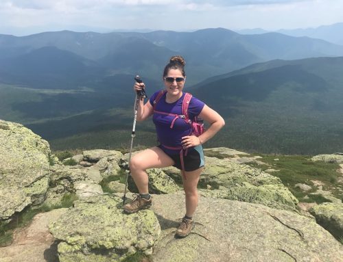
There is the ocean in the back.
Buzzards Roost– 3mile RT. This moderate loop peaks to the top of this mountain giving you views of the coast, Sycamore canyon and the Santa Lucia Mountains. I thought this was pretty, but if you are on a limited time schedule, I would not pick this hike. It takes a couple hours and the views are ok, not great in my opinion.
Mount Manuel Trail– 8 miles RT. This hike is a strenuous climb and the park rangers said not many people take this hike so it is grown in. I did not take this hike but if you’re looking for an adventure and own a pair of hiking pants, I would say go for it!
Pine Ridge Trail– 23 miles one-way. This backpacking trail is the most popular backpacking trail in the park. It offers spectacular views and what draws most people is the Sykes hot springs that is located 10 miles one-way into the trail. This hiking destination is very popular so expect crowds, especially if you go on a weekend. This hike also allows dogs.
*Just in my overall opinion, I think Julia Pfeiffer and Andrew Molera are prettier parks. This one is cool, it’s pretty, but in my opinion I just enjoyed the other two better. Minus the hot springs. I didn’t go there but if I did, I bet my opinion would change.
Andrew Molera State Park

This park is the biggest of all three with 4,766 acres of land. This park offers 25 miles of hiking trails. This is a multi-use area with mountain bikers and horseback riders. But most trails are just primarily for hikers. Many of these trails are interconnecting so you can make one big loop of the park, that pretty much encompasses a lot of the park. This loop (Bluffs trail-Panorama trail-Ridge trail) is highly advisable! It offers a lot of great overlooks into the ocean. This trail has many parts to it but it is basically the ridge trail and the panorama trail. The distance is 8.7 miles but completely worth it!!!! For this state park, I would recommend getting a trail map so you can adventure off to different trails, making your own loops.
Beach hiking– 2miles one-way. The trail starts from the mouth of the Big Sur River and goes to Cooper Point. Most of the beach is only accessible during low tide. Make sure you don’t venture out and get stuck at high tide or worse, carried out at sea. The tide here is very strong with no lifeguards available.
Beach Trail– 2 miles RT. This trail is the most popular beach trail that brings you out into the ocean. It is an easy hike that is relatively flat. You cross Big Sur River from the parking lot. There is a temporary bridge the park officials set up from the middle of June to the end of October. *Note-at the end of this trail is where the Panorama loops trail starts/ends.
Creamery Meadows Trail– 2 miles RT. Another easy trail, flat. This is the same starting point as the beach trail.
Bobcat Trail and Coyote Flat– 3.5miles RT. This trail is relatively easy. Not much in elevation and will bring you to a couple swimming holes.
*If you don’t have a map or don’t want to get one and want to do an epic loop, follow these instructions….

Take the beach trail to right where you approach the beach. You will see a trail on your left. If you want, go to the beach and check it out first, the come back to the fork. Take this trail. It will bring you down the coast (not directly on the beach, but right next to it).

Ocean to the right, you are up on land.
The ocean will be to the right of you for quite some time. Eventually there will be a fork. You can head right if you want. It is just a little vista, but then come right back and continue on to the left. This is the main loop. You will eventually be curving left since it is a loop, bringing you farther away from the coast. It becomes more uphill until you reach the half-way point. Once you reach the top, and you will know when that happens because there is a phenomenal view, just past this view point, there will most likely be people eating lunch up there. This is a popular break point.

Following the trail along the coast, masked in flowers!!!!!
Then you continue on and this is where it becomes tricky. You can either just take this path all the way to the parking area or continue the adventure and make it longer by adding on some more trails. You aren’t putting too much more mileage on. Just a couple more miles I would say to see different things. You take the hidden trail on the right (and this is after you are now coming down-hill from after the half-way point. The hidden trail will end and this is where you make another decision to turn left toward the car (you will take the river trail back), or turn right and do the cottonwoods trail loop.

This is a loop so you will loop around and come back from where you were at the hidden trail and you will continue on the river trail. But while you are on the twin cottonwoods trail loop, you have another option, and this is what I did, I crossed the river, there is no bridge to get to bobcat trail where there are swimming holes. It is another loop, so you will do the loop and simply head back on the bobcat trail to the park entrance.

One of the swimming holes. I pretty much took a bath in it. It felt soooo good!!!!!!!
All these side trails aren’t long. It is almost just as long as the trail you will take to the parking lot anyway on the main loop you are on in the first place. You are just going maybe a mile or two more. You are just going to the right more and simply paralleling the original trail, just adventuring off into different trails. Hope that makes sense. Most likely you will find someone that knows where they are going if you get lost. Or in my case, I found someone with a map and took a picture of their map. The park didn’t have any trail maps available for some reason.

Snake!!!!!
Well, that is basically the gist of the Big Sur with the three State Parks that encompass it. If you would like a topo map of the area, you can get it here! It’s a great area with great views and a lot of different options to enjoy the park whether it be driving, hiking, horse-back riding, mountain biking, swimming, surfing, fishing, and/or camping. Hope you have a good time at Big Sur!!!! I know I did!
Thank you for reading!!!!
Sincerely,
Shelly

Leave A Comment