
The Yellow Aster Butte trail, located in the state of Washington, is a short but strenuous 2.5 mile hike to the top. It is in the Mount Baker Wilderness and has phenomenal views! One of my favorite hikes in the Mount Baker area!
There is a campground up there that offers great views where you can catch the sunset and sunrise off the surrounding mountains! You also will most likely get your very own alpine lake. There were several alpine lakes up there with segregated camping, so if you are looking for solitude, but to where people are still around, this is your spot.

My camping spot for the night!!!!
About 1 1/2 miles in, the trail splits off to a lake. I never went this way, but most people go to Yellow Aster Butte Trail because of the spectacular views up top. Dog are allowed on this trail. I would go mid summer to late summer. I went mid summer and snow still lingered on the trail, but completely passable. It’s just early summer and before that I would be a little worried.

Very own alpine lake
I had a hiking partner for this trek which I was grateful for. Jacob and I camped at the top and had some celebratory drinks :). It was a great time to relax with great views and an alpine lake!

My hiking partner Jacob
I took advantage of this lake for a bath! Had my biodegradable soap and cleaned myself up.

Getting down with my writing!
For all you environmentalists out there, I cleaned up on shore. I didn’t put the soap in the lake. I heard even though it is biodegradable, that doesn’t mean it’s good for the environment and it still takes a while for it to break down. It doesn’t break down right away.

Hello Mountain!!!!

Here is your official Trail Description!!!!
Directions:
Below is a link to get there.

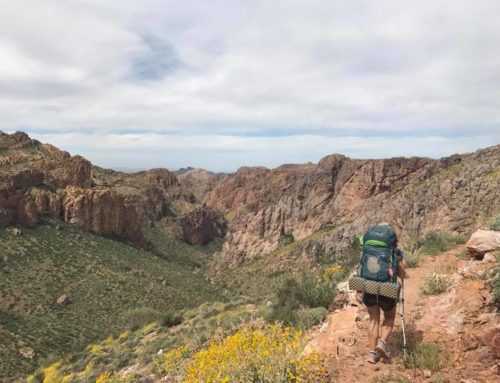
My backpack and I. We’ve bonded so much already!!!
https://goo.gl/maps/brzcH4YPRR82
As soon as you put it in Google Maps, it pops right up. It is North or North Cascades National Park so you are really far up north. You are just about on the border of Canada. You take 542 to get there and take a left after this building that is also on the left-hand side.
It’s a dirt road with plentiful potholes. The road is NF 3065. You follow this road up. I was in a chevy cruise and made it to the trail head. Someone told me you needed 4 wheel drive. No way! I did it just fine and have been through a lot worse.
Hope you get to enjoy this hike! It’s a great one! Thank you for reading and hope you enjoyed!!!
Sincerely,
Shelly/Livingonthedirt
I’m so jealous of your camping spot! What a way to wake up!
I know of 9 people to date that have gone missing up there. I only live about 90 minutes away and go up there as often as possible to go trail running.
I have found trails that only the wildlife know about that used to be trails used by Native Americans. It’s incredible to take them into the backwoods where you can find campsites from a long, long time ago.
I did what you’re doing now, 20 years ago for 5 years and I have to say that Washington state is the best state in the country.
Especially if you want to get lost.
(evil laugh)
Wow, Jack that is scary. I had no idea that the trail was that easy to get lost on. I am glad you said something. Now people will know to be extra careful on this hike!!!!
No no no, sweet human. Not “lost”… rather, purposely removed. I won’t elaborate on your site and by no means am I attempting to ‘freak’ anyone out. But what we’re talking about here is something that the rest of the country doesn’t get.
You can email me personally and I’ll give you the information. I was a guide for a few years and am a scholar so I enjoy finding out as much as I can.
Dig your site! : )